About
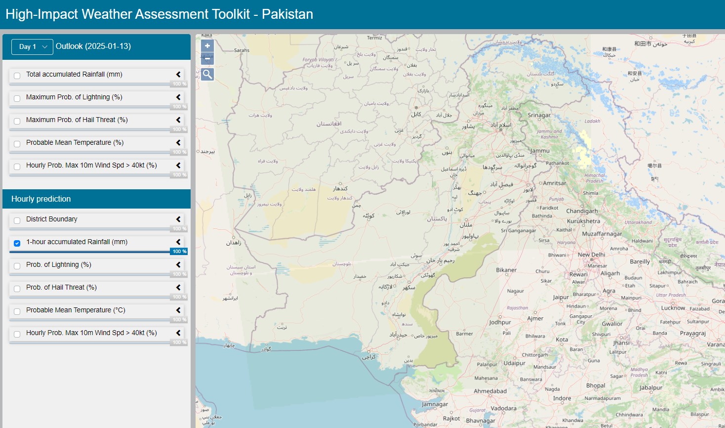
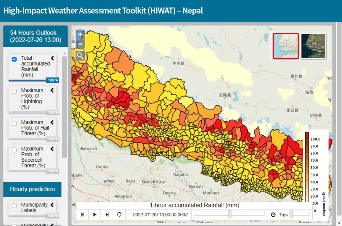
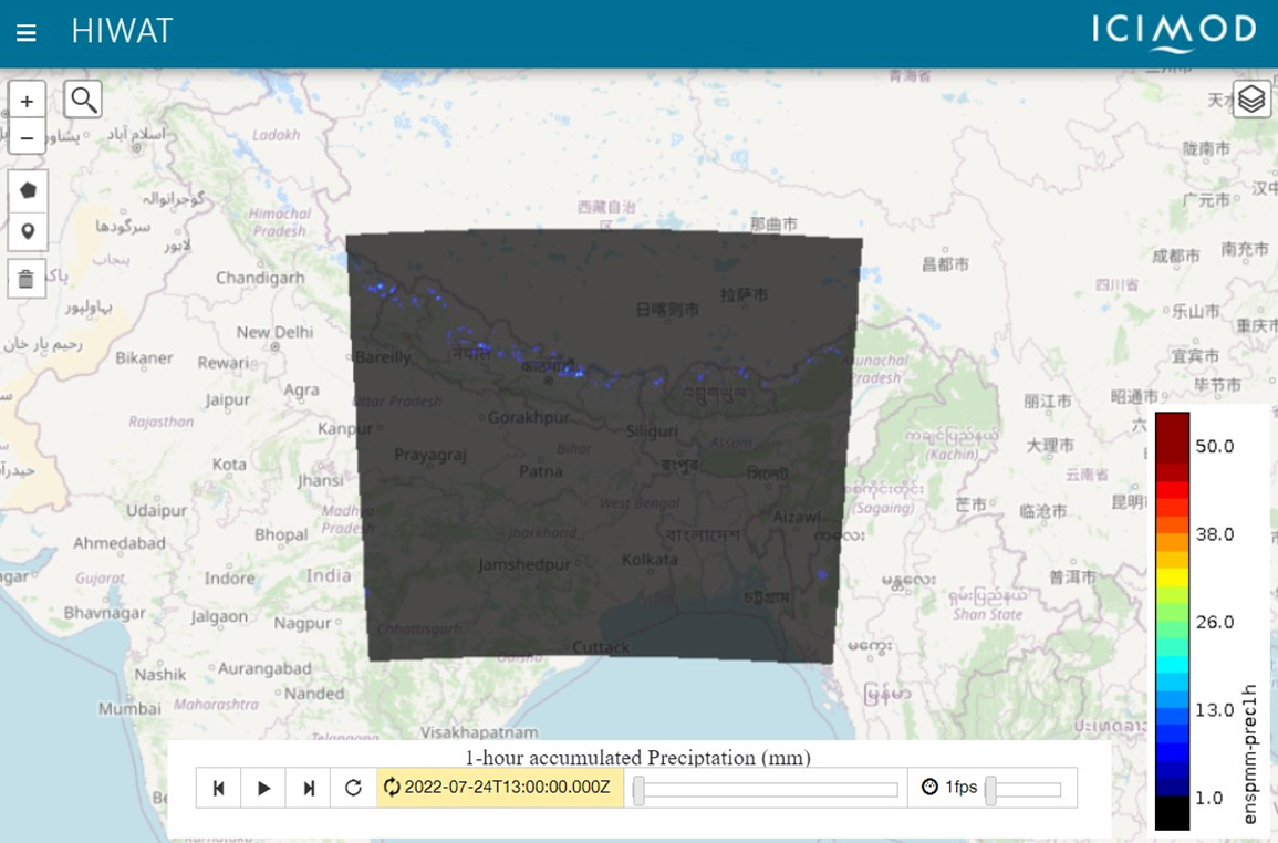
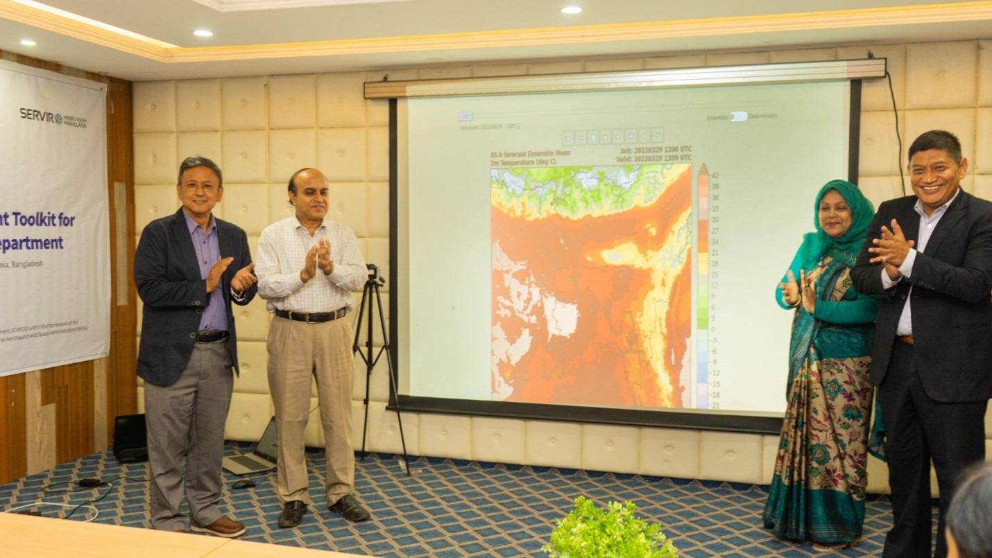
The Monitoring Extreme Weather in the Hindu Kush Himalaya (HKH) service provides customized numerical weather predictions to assess high impact weather events over the HKH region using the High Impact Weather Assessment Toolkit (HIWAT). HIWAT uses a mesoscale numerical weather prediction model and the Global Precipitation Measurement (GPM) constellation of satellites. The toolkit includes a suite of ensemble model forecasts to constrain the uncertainties and provide a probabilistic forecast for improved decision making. The toolkit provides outlooks for lightning strikes, high impact winds, high rainfall rates, hail damage, and other weather events.
The HIWAT system provides an outlook for temperature, 54 for hours in advance. The outlook covers Bangladesh, Nepal, and Bhutan, Pakistan, Afghanistan, as well as parts of and northeast India. HIWAT also provides critical inputs for the Flash Flood Prediction Tool (FFPT), providing communities with locally relevant data; a Fire Weather Index (FWI) product, which is essential for informing land and fire management teams within Nepal; and the LHASKarnali tool for forecasting landslides in Karnali River Basin in Nepal. A mobile application, “Prakop Alert” was launched in the Google App Store in April 2024 that provides HIWAT information at the community level.
Rationale
Extreme weather events claim many human lives and cause economic losses every year in the HKH region. HKH is a hotspot for some of the most intense thunderstorm activity taking place globally. However, the region lacks in situ observations for monitoring thunderstorms due to both the remoteness of the region as well as limited technical and economic capacity. As a result, the monitoring and evaluation of extreme weather events in HKH to assess their geographic scale and the damage after they occur is seldom carried out.