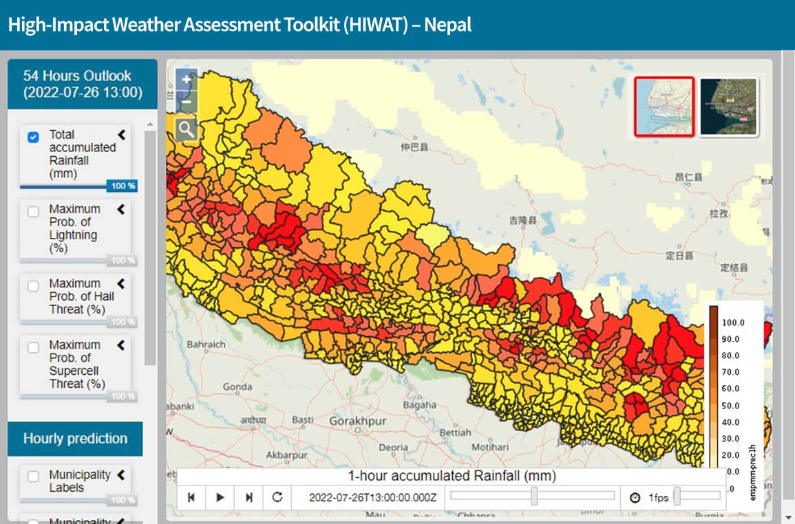
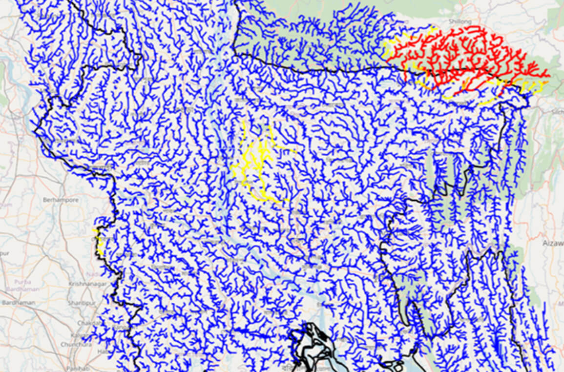
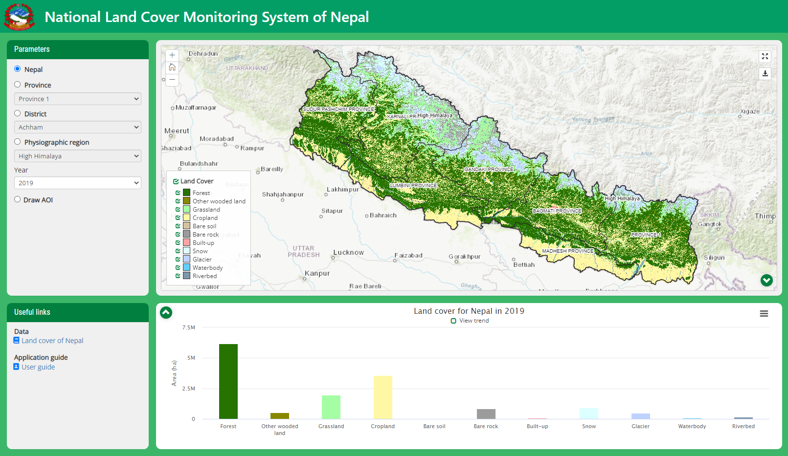
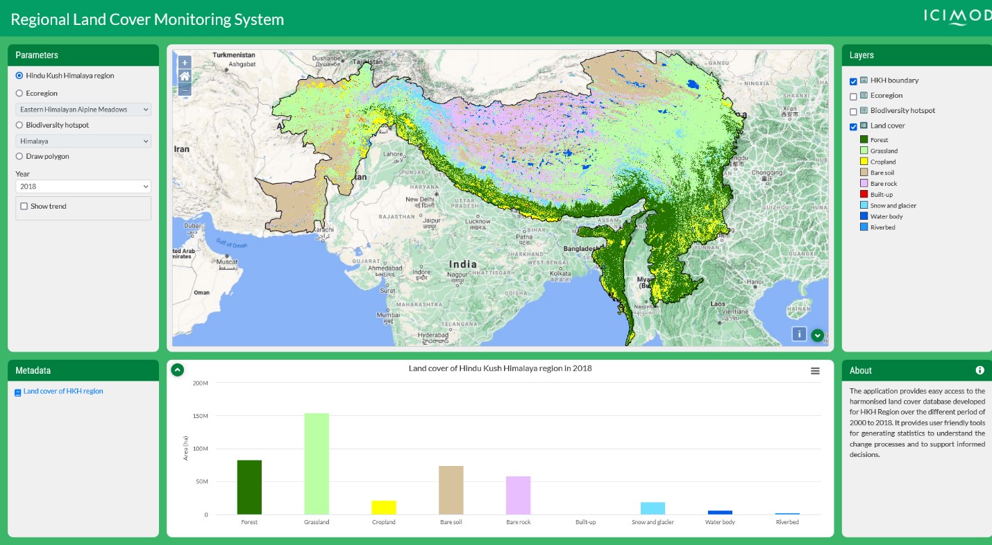
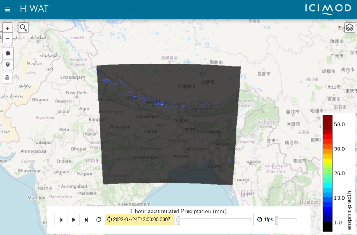
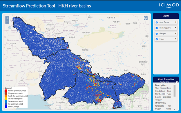
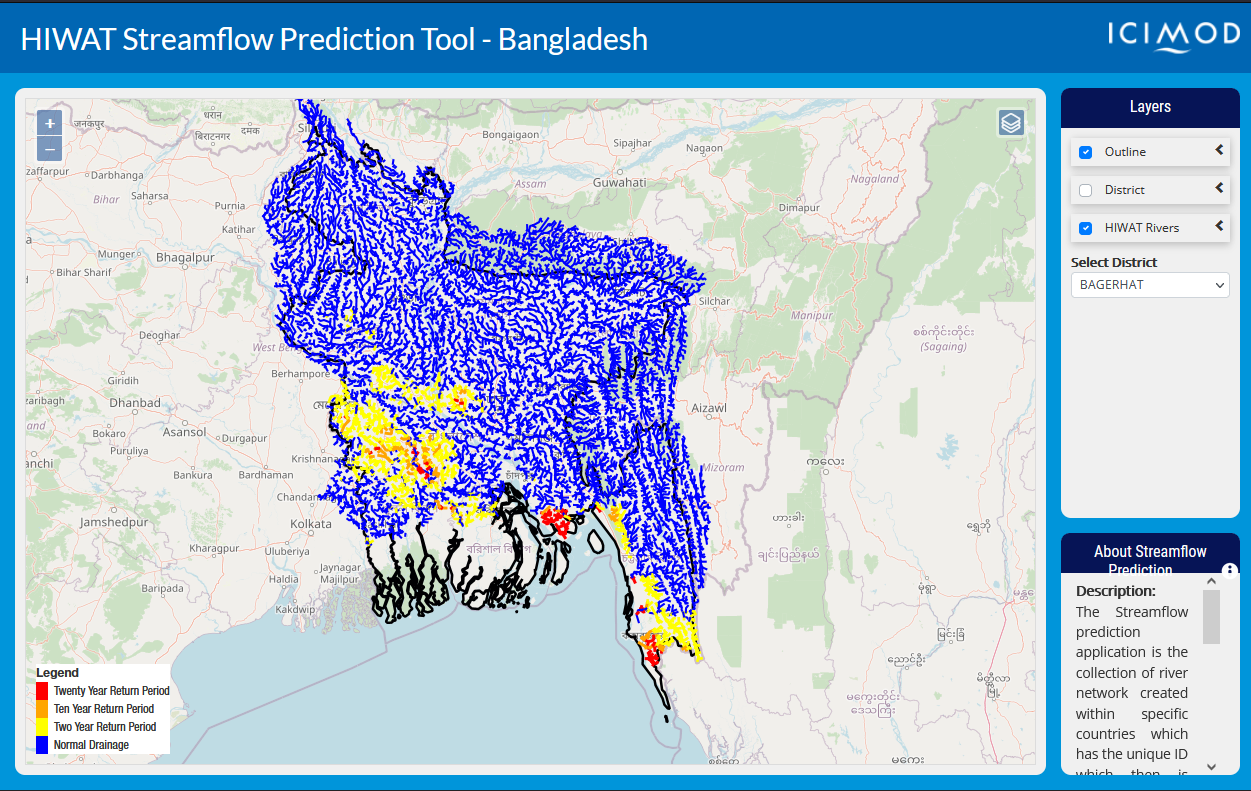
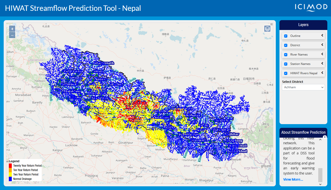
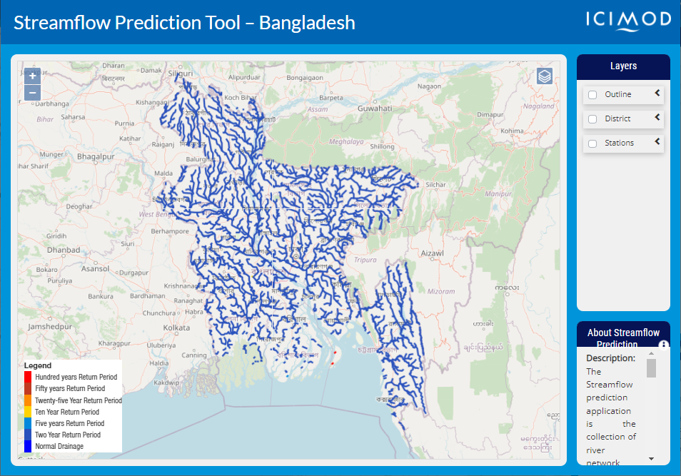
Explore Servir HKH

Find the information you need by entering keywords below.

Tools

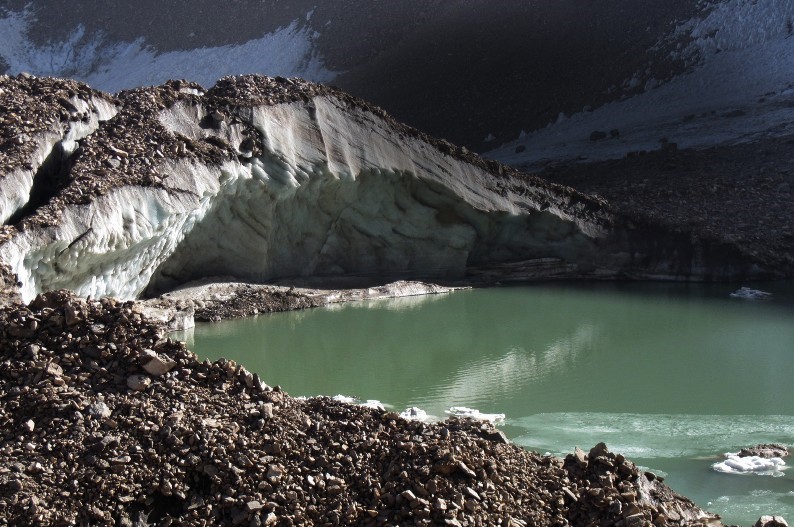
SERVIR-HKH uses data from a collection of Earth observing satellites, ground-based data and advanced geospatial information technology in innovative ways to help decision makers respond to environmental challenges in the Hindu Kush Himalaya. Applications and tools developed under the SERVIR-HKH initiative provide evidence for decision making in the region. These applications and tools are available as dedicated services that can be classified under thematic areas – Agriculture and Food Security, Ecosystem and Carbon Management, Weather and Climate Resilience, Air Quality and Health.

All science applications developed under SERVIR-HKH are made available online on Mountain Geoportal. The Mountain Geoportal is ICIMOD’s designated space for all science applications and hosts innovative and interactive web applications that provide dynamic visualization of spatial data and other geospatial information services.

About The High-Impact Weather Assessment Toolkit (HIWAT) for Nepal uses a mesoscale numerical weather prediction model and the Global Precipitation Measurement (GPM) co ...
Regions:
Nepal
About The Flash Flood Prediction Tool for Bangladesh provides 54-hour flash flood forecasts for 10,049 river segments in Bangladesh. The tool provides predicted estimat ...
Regions:
Bangladesh
About The Flash Flood Prediction Tool for Nepal provides 54-hour flash flood forecasts for 12,428 river segments in Nepal. The tool provides predicted estimates for fla ...
Regions:
Nepal
About Nepal’s National Land Cover Monitoring System (NLCMS) was developed by the Forest Research and Training Centre (FRTC) with technical support from SERVIR-HKH, a ...
Regions:
Nepal
About The Regional Land Cover Monitoring System (RLCMS) for the Hindu Kush Himalaya (HKH) region is an operational service that provides annual land cover mapping and c ...
Regions:
Nepal, Afghanistan, Regional, Bangladesh, Myanmar
About The Flood Inundation Mapping Tool is a cloud-based system that maps flood areas in Bhutan, Bangladesh, Nepal, and Northeast India. The tool uses Sentinel-1 Synthe ...
Regions:
Nepal, Bangladesh
About The High-Impact Weather Assessment Toolkit (HIWAT) uses a mesoscale numerical weather prediction model and the Global Precipitation Measurement (GPM) constellatio ...
Regions:
Regional
About The Streamflow Prediction Tool for the HKH river basins provides 10-day streamflow forecasts for major rivers within the Amu Darya, Brahmaputra, Ganges, and Indus ...
Regions:
Nepal, Regional, Bangladesh, Bhutan
About 1 Kunj glacier and glacial lake in Panjshir, Kabul basin, Afghanistan, in August 2018 (Photo: Mahboobullah Bariz/NWARA) The National Water Affairs Regulation Auth ...
Regions:
Afghanistan
About The High-Impact Weather Assessment Toolkit (HIWAT) Streamflow Prediction Tool for Bangladesh provides 54-hour flash flood forecasts for 10,049 river segments in B ...
Regions:
Bangladesh
About The High-Impact Weather Assessment Toolkit (HIWAT) Streamflow Prediction Tool for Nepal provides 48-hour flash flood forecasts for 12,428 river segments in Nepal. ...
Regions:
Nepal
About The Streamflow Prediction Tool for Bangladesh provides 10-day forecasts for major river systems in Bangladesh. The Flood Forecasting and Warning Center (FFWC) use ...
Regions:
Bangladesh

No Results Found

Please consider trying different keywords.

background-tools-global