
About
Our Regional Land Cover Monitoring System is a first-of-its-kind resource for the region
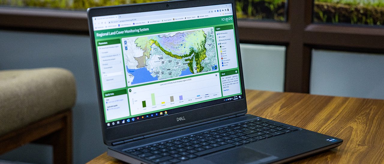
Recognising the data gaps in land cover and inconsistencies in land cover maps in the HKH region, we launched our Regional Land Cover Monitoring System (RLCMS), which provides annual land cover mapping and change analysis through generating spatially seamless and temporally consistent annual land cover maps. The systems uses broad land use categories recommended by the IPCC, which are suitable for monitoring changes in forest cover and carbon stocks, and urbanisation extent at the regional level.Our web-based application provides easy access to the harmonised land cover database for the entire HKH region from 2000 to 2018. It provides user-friendly tools to generate maps, charts, and statistics that improve understanding of the change processes and aid informed decision making. The system is being further customised to generate annual land cover data for Afghanistan, Bangladesh, Myanmar, and Nepal.
The RLCMS will improve reporting on forest cover change and support lawmakers in making evidencebased policies to improve related land management practices. Additionally, it will support relevant government departments in making policies, planning, and managing their forestry sector.