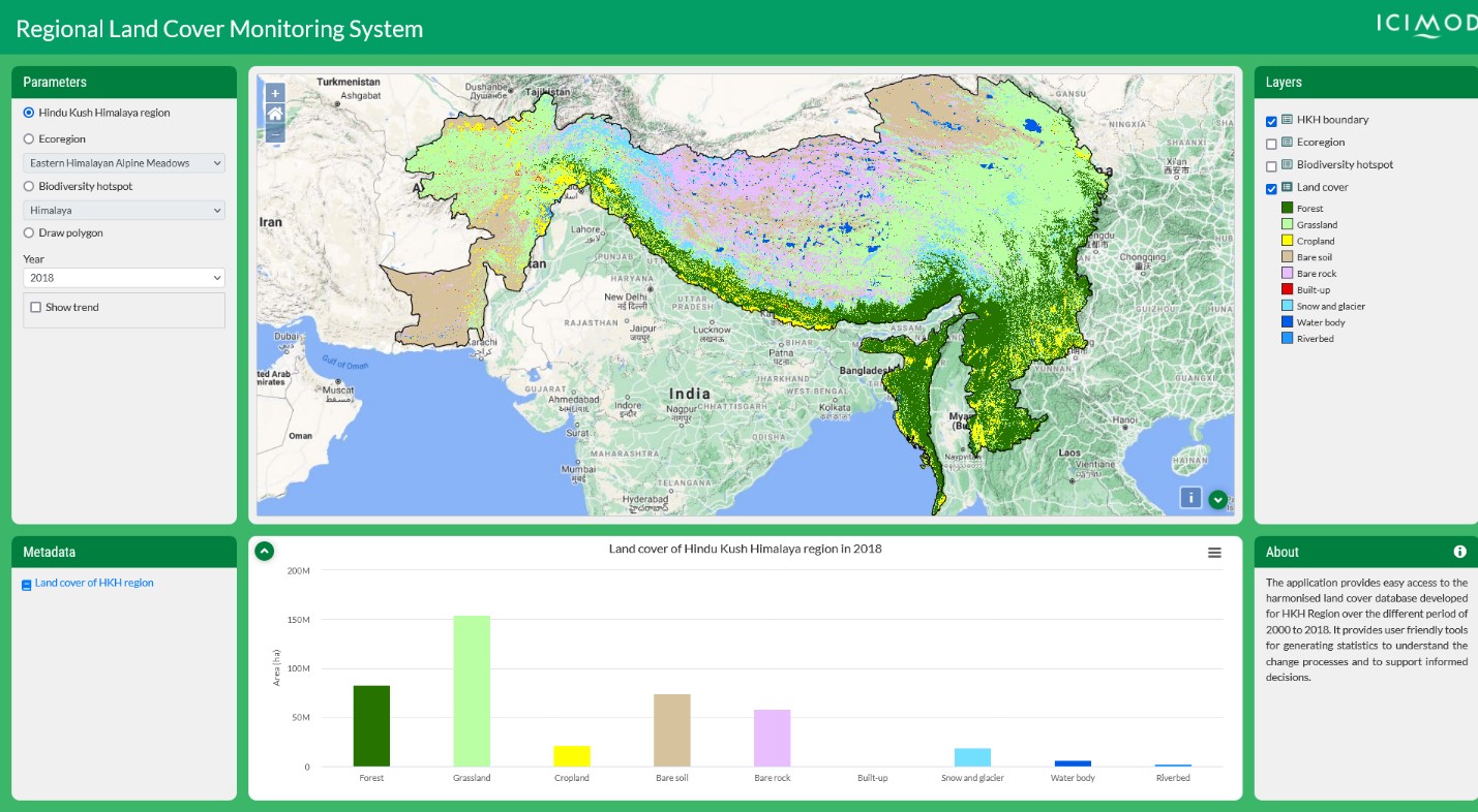
About
Accurate and timely land cover data is essential for making informed land management decisions. But in regions such as South Asia, many decision makers don’t have access to this data. In 2021, SERVIR Hindu Kush Himalaya (HKH) officially launched the Regional Land Cover Monitoring System (RLCMS) for the HKH region. The outputs of this project help support forest management and degradation monitoring efforts in throughout South Asia
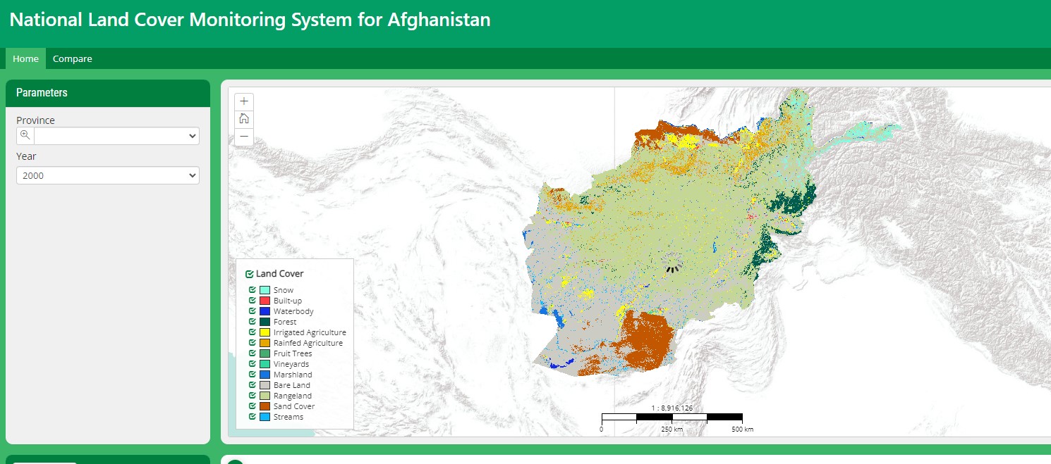
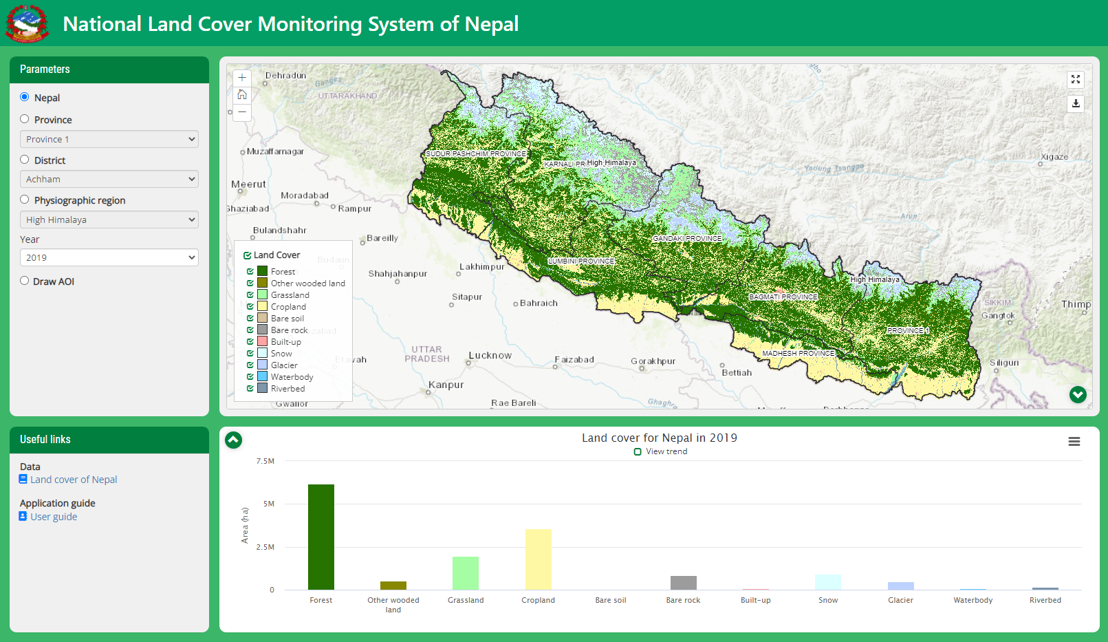
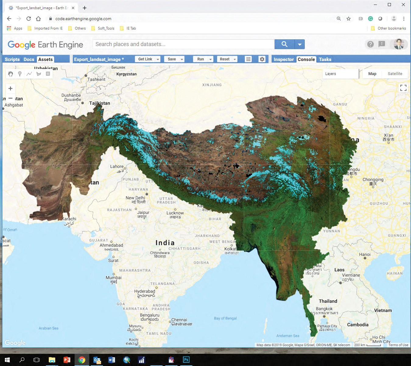
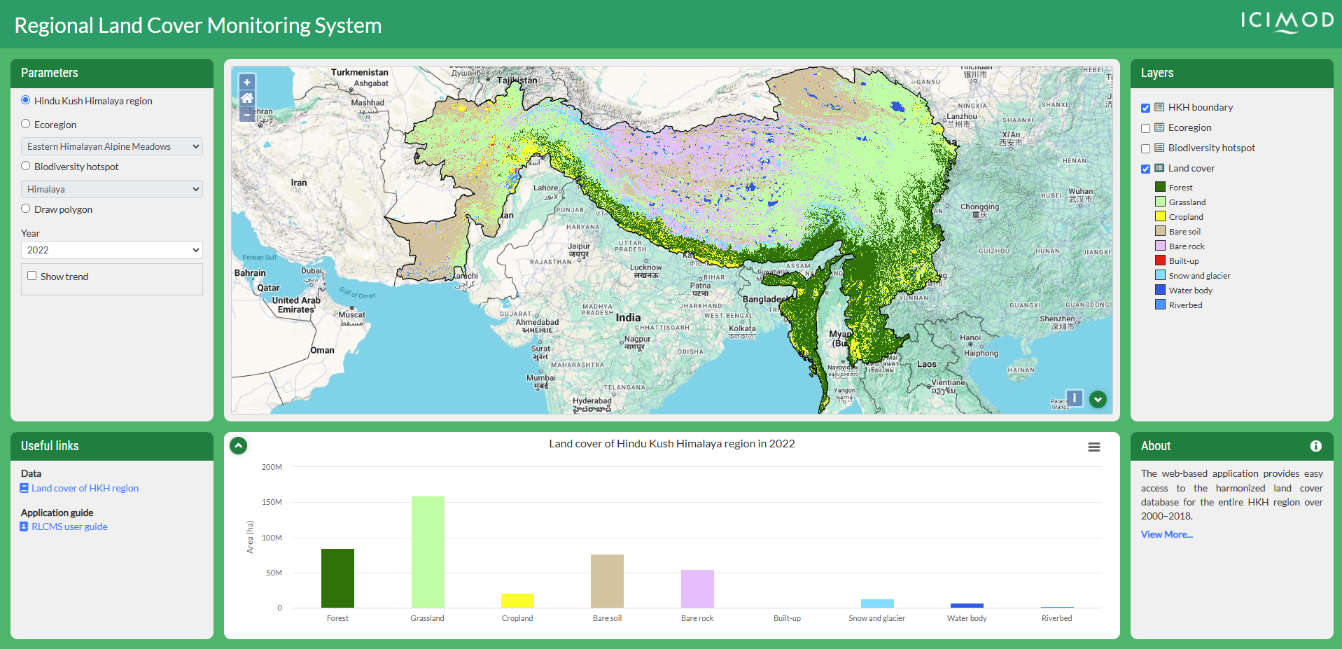
The RLCMS is built on the Google Earth Engine (GEE) computational platform using a modular architecture, enabling the development of land cover maps on both national and regional level. This scalability enabled the development of the National Land Cover Monitoring System (NLCMS) of Nepal. It was launched on Earth Day 2022 and endorsed as the official mapping system of Nepal. The RLCMS platform has proven vital for the entire South Asia region, serving forest carbon tracking along with other essential monitoring functions.
SERVIR HKH collaborated with a range of regional and global partners to develop the tool, including SERVIR Southeast Asia, which launched its own RLCMS in 2018.
Rationale
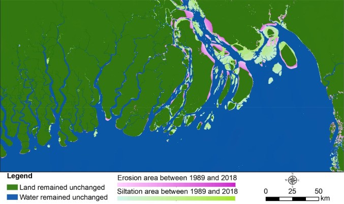
Land cover mapping is one of the most common applications of Earth Observation (EO), which plays a vital role in providing meaningful information about the Earth’s surface. In the HKH region, land cover changes are occurring at an alarming rate due to the combined effects of rapid economic growth and population pressures. These changes pose significant challenges to the long-term sustainability of ecosystems and the essential services they provide, such as food, water, and energy. Unfortunately, there is a considerable data gap in accessing regularly updated land cover information for effective change detection, monitoring, planning, policy formulation, management, and meeting national and international reporting requirements. Addressing this data gap is crucial for informed decision-making and implementing sustainable land management practices in the HKH region.
Furthermore, tracking of forest carbon and its dynamics are essential to meet the Sustainable Development Goals (SDG) and climate change mitigation actions such as REDD+. This service also aims to examine above ground forest carbon stock (AFCS) estimation via locally calibrated methods using open source EO data and field measurement data and strengthen the capacity of stakeholders on AFCS assessment with specific focus to Nepal and Bangladesh.